World Heritage Mangrove Forest Sundarban has started a survey to determine the number and number of different species of trees. The tree survey work started from Tuesday under the supervision of the forest department. The forest department will complete this work within the next three months.
This survey is being conducted to find out how many species and what amount of plants are there in the land area of 4 thousand 142.6 square kilometers of this mangrove forest with an area of 6 thousand 17 square kilometers of Bangladesh part of Sundarbans.
According to the information of the forest department, there were 334 species of plants, 165 species of algae and 13 species of orchids in the Sundarbans in 1903. In the 1985 survey, the number of forest and shrub species in the Sundarbans decreased to 66 species. In the 1997 survey there were only 48 plant species in the Sundarbans.
Then in the latest survey of 2014-15, the number of tree species in Sundarbans increased to 184. Among them, there are 54 species of trees, 28 species of foliage, 13 species of shrubs, 22 species of shrubs, 13 species of ferns, 12 species of orchids, 3 species of parasitic plants, 2 species of palms, 28 species of grasses and 9 species of fungi in the Sundarbans. Currently, 70 percent of these plants in the Sundarbans are Sundari, Gewa and Garan trees.
Divisional Forest Officer of Sundarban East Forest Division Kazi Muhammad Nurul Karim said that the tree survey work of this forest area has started from Tuesday to find out how many species and what amount of plants are on the ground of the entire Sundarbans of Bangladesh. The forest officers and employees of the forest department will complete this survey within the next three months.
Forest is the lung of the Mother Earth. Without forest it’s impossible to live in the world. That’s mean no forest no life. The word “forest” comes from old French word forest (also fores). And the Bans word derives from the English Word Forest. The first known forests on Earth arose in the Late Devonian (approximately 380 million years ago), with the evolution of Archaeopteryx.
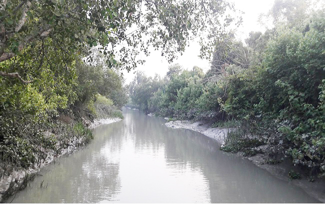
A mangrove is a shrub or small tree that grows in coastal saline or brackish water. The term is also used for tropical coastal vegetation consisting of such species. Mangroves occur worldwide in the tropics and subtropics, mainly between latitudes 25° N and 25° S. The total mangrove forest area of the world in 2000 was 137,800 square kilometers (53,200 sq mi), spanning 118 countries and territories.
Mangroves are salt-tolerant trees, also called halophytes, and are adapted to life in harsh coastal conditions. They contain a complex salt filtration system and complex root system to cope with salt water immersion and wave action. They are adapted to the low oxygen conditions of waterlogged mud. Although mangroves inhabit only 0.7% of global coastal zone, but they have a significant contribution to the global carbon. Primary production by mangroves provides a substantial source of energy for aquatic food webs.
In the coastal area of Bangladesh there are huge natural mangrove forests. Sundarbans is the biggest natural mangrove forest in the world, located between Bangladesh and India. The most beautiful part of the Sundarbans consists of Bangladesh and it is 60%. It is the deepest with the different types of geological periods and fauna. If you want to get a true experience of the mangrove forest, you must visit the Bangladesh side of the Sundarbans.
The Sundarbans is a mangrove area in the delta formed by the confluence of the Ganges, Brahmaputra and Meghna Rivers in the Bay of Bengal. It spans from the Hooghly River in India’s state of West Bengal to the Baleswar River in Bangladesh. It comprises closed and open mangrove forests, agriculturally used land, mudflats and barren land, and is intersected by multiple tidal streams and channels. Four protected areas in the Sundarbans are enlisted as UNESCO World Heritage Sites, viz. Sundarbans National Park, Sundarbans West, Sundarbans South and Sundarbans East Wildlife Sanctuaries. Despite these protections, the Indian Sundarbans were considered endangered in a 2020 assessment under the IUCN Red List of Ecosystems framework.
The Sundarbans mangrove forest covers an area of about 10,000 sq km (3,900 sq mi), of which forests in Bangladesh’s Khulna Division extend over 6,017 sq km (2,323 sq mi) and in West Bengal, they extend over 4,260 sq km (1,640 sq mi). The most abundant tree species are sundari (Heritiera fomes) and gewa (Excoecaria agallocha). The forests provide habitat to 453 faunal wildlife, including 290 bird, 120 fish, 42 mammal, 35 reptile and eight amphibian species.
The Sundarbans freshwater swamp forests are a tropical moist broadleaf forest eco region of Bangladesh. It represents the brackish swamp forests that lie behind the Sundarbans Mangroves, where the salinity is more pronounced. The freshwater eco region is an area where the water is only slightly brackish and becomes quite fresh during the rainy season, when the freshwater plumes from the Ganges and the Brahmaputra rivers push the intruding salt water out and bring a deposit of silt. It covers 14,600 square kilometres (5,600 sq mi) of the vast Ganges-Brahmaputra Delta, extending from the northern part of Khulna District and finishing at the mouth of the Bay of Bengal with scattered portions extending into India’s West Bengal state. The Sundarbans freshwater swamp forests lie between the upland Lower Gangetic plains moist deciduous forests and the brackish-water Sundarbans mangroves bordering the Bay of Bengal.